


Productive mines and exploration projects depend on being able to build detailed geologic and resource models based on timely and efficient collection of geological data. Exploration geologists, field technicians, and resource geologists all have a role to play. And are all under pressure to produce.
Iterations of explicit geologic modeling take time; time that could be spent analyzing information, testing theories, and otherwise being a geologist. Likewise, updating the resource block model and reserves estimates to reflect new data is also time consuming. The block model is the foundation of all planning tools and is the single source of truth for how mines manage their resources; an up-to-date block model is critical in a modern mining environment.
For more than 50 years and in hundreds of mines worldwide, Hexagon’s general mine planning portfolio, MinePlan, has been assisting in visualization, design, resource modeling and reserves calculation. New to the portfolio is HxGN MinePlan GeoSlate, a mobile geological drillhole logging application that simplifies the field data collection process.
Classic geomodeling methods and resource estimation iterations can take weeks or months to construct one interpretative scenario. But modern mines and exploration projects do not have the luxury to wait on model updates to make decisions. The trend is to update your geologic and resource models live to be streamlined with the rest of the planning process.
Introducing GeoSlate
GeoSlate integrates directly with MinePlan 3D, Hexagon’s tailor-made graphics solution for mine CAD design. Field drillhole data is collected on a recommended field-ready mobile tablet using the GeoSlate app and preconfigured logging templates. Designed to emulate the field geologist’s workflow, the logging app is easy to use and saves field personnel valuable time.
Data can be instantly published over Wi-Fi using Hexagon’s microservice technology, syncing directly to connected MinePlan drillhole databases for subsequent geologic analysis and workflow execution at the click of a button.
Available as part of MinePlan’s Exploration Geo package, GeoSlate saves time by eliminating the hassle of configuring logging templates from scratch. It solves many of the challenges facing geologists who are tasked with geological, exploration, production, sampling, geotechnical, hydrogeological and other field data collection and data management needs.
The addition of GeoSlate to MinePlan’s Geosciences Suite fills an important step in the exploration and resource geo workflow.
Geoscientists can now complete their entire workflows in MinePlan, from the initial stages of drillhole design and field data collection through data management, QA/QC, 3D geomodeling, and resource estimation.
Using one solution means a seamless, auditable process from start to finish: not to mention freeing up more time to be a geologist!
More information
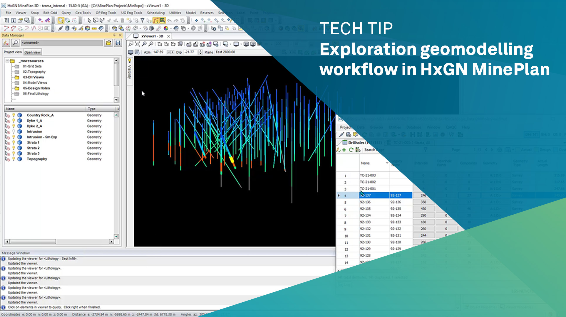
Teresa Cruz, Mine Planning Specialist, demonstrates how GeoSlate completely integrates in the geomodeling workflow, from drillhole design through interpretation and 3D implicit modeling using our auditable GeoLogic tool.
GeoSlate press release.
The latest MinePlan release also includes enhancements throughout the product suite, including in Activity Scheduler, Schedule Optimizer, GeoLogic, and the core MinePlan 3D platform. Customers can download the latest version of MinePlan or other product releases, at the Client Center, or contact technical support to find out more about the release.